Auction No 430, Category: Topography
6 Lots (displaying 1 - 6)
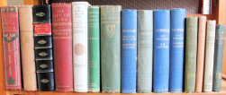
Various including A. & C. Black topography (7), five illustrated by Heaton Cooper (one rebound in half-leather); Temple "The Gytrash of Goathland",
Various including A. & C. Black topography (7), five illustrated by Heaton Cooper (one rebound in half-leather); Temple "The Gytrash of Goathland",
Lot 12
Lot: 12
- Auction Date: Wed 20th Nov 2024 12:00 GMT (Ended)
- Est: £40 - £60
UNSOLD
MORE DETAILSVarious including A. & C. Black topography (7), five illustrated by Heaton Cooper (one rebound in half-leather); Temple The Gytrash of Goathland, 1928; Pendlebury The Archaeology of Crete, 1967, in d/jkt; and Le Plutarque de l'Enfance, 1812, engraved plates, improvised wraps. (16)
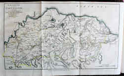
John Graves "The History of Cleveland, in the North Riding of the County of York", Carlisle, 1808, worn half-leather, gilt title, fine folding map
John Graves "The History of Cleveland, in the North Riding of the County of York", Carlisle, 1808, worn half-leather, gilt title, fine folding map
Lot 107
Lot: 107
- Auction Date: Wed 20th Nov 2024 12:00 GMT (Ended)
- Est: £40 - £60
SOLD £24
MORE DETAILSJohn Graves The History of Cleveland, in the North Riding of the County of York, Carlisle, 1808, worn half-leather, gilt title, fine folding map hand-coloured in outline, folding pedigree, and engraved plates; preliminary leaves browned and stained, front hinge weak; and Elgee The Moorlands of North Eastern Yorkshire, 1912, fine folding map & plates, ownership signature front endpaper. (2)
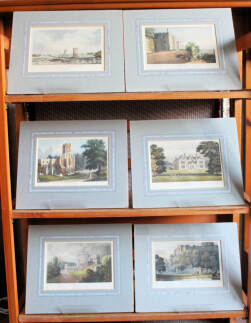
Thomas Moule "Great Britain Illustrated: A Series of Original Views from Drawings by William Westall", London, 1830; quarter-leather, gilt,
Thomas Moule "Great Britain Illustrated: A Series of Original Views from Drawings by William Westall", London, 1830; quarter-leather, gilt,
Lot 120
Lot: 120
- Auction Date: Wed 20th Nov 2024 12:00 GMT (Ended)
- Est: £30 - £50
SOLD £40
MORE DETAILSThomas Moule Great Britain Illustrated: A Series of Original Views from Drawings by William Westall, London, 1830; quarter-leather, gilt, worn corners, 118 engravings (two per page) some plates & engraved title with light foxing (one page badly foxed) but generally clean internally; together with 10 fine hand-coloured engravings, a 1787 map of Middlesex, and three lithographs, all in card mounts.
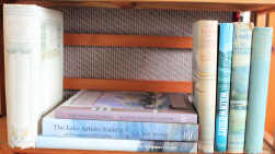
W.T. Palmer "The English Lakes painted by A. Heaton Cooper", A. & C. Black, 1905, de-luxe edition, No.126 of 250, signed by the artist
W.T. Palmer "The English Lakes painted by A. Heaton Cooper", A. & C. Black, 1905, de-luxe edition, No.126 of 250, signed by the artist
Lot 121
Lot: 121
- Auction Date: Wed 20th Nov 2024 12:00 GMT (Ended)
- Est: £120 - £150
UNSOLD
MORE DETAILSW.T. Palmer The English Lakes painted by A. Heaton Cooper, A. & C. Black, 1905, de-luxe edition, No.126 of 250, signed by the artist on limitation page, decorated cloth, top edge gilt, uncut elsewhere; foot of spine a little frayed, small stain to left of front board; armorial bookplate of James B. Gallie; together with W. Heaton Cooper The Tarns of Lakeland, 1960, in VG d/jkt, and The Hills of Lakeland 1938; Renouf The Lake Artists Society – A Centenary Celebration, 2004, in d/jkt; and related titles. (8)
"Kelly’s Directory of Manchester, Salford and Stretford" 1967, gilt cloth, 1482pp + prelims; and "Kelly’s Map of Manchester & Salford"
"Kelly’s Directory of Manchester, Salford and Stretford" 1967, gilt cloth, 1482pp + prelims; and "Kelly’s Map of Manchester & Salford"
Lot 123
Lot: 123
- Auction Date: Wed 20th Nov 2024 12:00 GMT (Ended)
- Est: £30 - £50
UNSOLD
MORE DETAILSKelly's Directory of Manchester, Salford and Stretford 1967, gilt cloth, 1482pp + prelims; and Kelly's Map of Manchester & Salford showing tram lines in red, taken from an earlier edition. VG condition.
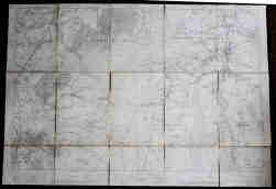
Map of Whaley Bridge, Kettleshulme & Pott Shrigley: Ordnance Survey 1913, 6 inches to the mile, dissected, cloth-backed. 32 x 40”
Map of Whaley Bridge, Kettleshulme & Pott Shrigley: Ordnance Survey 1913, 6 inches to the mile, dissected, cloth-backed. 32 x 40”
Lot 124
Lot: 124
- Auction Date: Wed 20th Nov 2024 12:00 GMT (Ended)
- Est: £10 - £20
UNSOLD
MORE DETAILSMap of Whaley Bridge, Kettleshulme & Pott Shrigley: Ordnance Survey 1913, 6 inches to the mile, dissected, cloth-backed. 32 x 40”
