Auction No 430, Category: Maps
5 Lots (displaying 1 - 5)
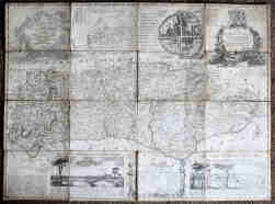
Antique Maps including North Africa 1789 (47 x 82cm) by E.A. Schraembl, Vienna; Sussex by Bowen 1750s (42 x 68cm) dissected, cloth-backed;
Antique Maps including North Africa 1789 (47 x 82cm) by E.A. Schraembl, Vienna; Sussex by Bowen 1750s (42 x 68cm) dissected, cloth-backed;
Lot 122
Lot: 122
- Auction Date: Wed 20th Nov 2024 12:00 GMT (Ended)
- Est: £40 - £60
SOLD £62
MORE DETAILSAntique Maps including North Africa 1789 (47 x 82cm) by E.A. Schraembl, Vienna; Sussex by Bowen 1750s (42 x 68cm) dissected, cloth-backed; two hand-coloured strip maps (Monmouth to St. David's); and England & Wales by Wallis 1798. Most hand-coloured in outline. Small faults to the Sussex map. (7)
"Kelly’s Directory of Manchester, Salford and Stretford" 1967, gilt cloth, 1482pp + prelims; and "Kelly’s Map of Manchester & Salford"
"Kelly’s Directory of Manchester, Salford and Stretford" 1967, gilt cloth, 1482pp + prelims; and "Kelly’s Map of Manchester & Salford"
Lot 123
Lot: 123
- Auction Date: Wed 20th Nov 2024 12:00 GMT (Ended)
- Est: £30 - £50
UNSOLD
MORE DETAILSKelly's Directory of Manchester, Salford and Stretford 1967, gilt cloth, 1482pp + prelims; and Kelly's Map of Manchester & Salford showing tram lines in red, taken from an earlier edition. VG condition.
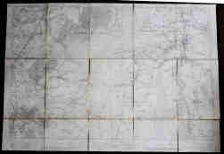
Map of Whaley Bridge, Kettleshulme & Pott Shrigley: Ordnance Survey 1913, 6 inches to the mile, dissected, cloth-backed. 32 x 40”
Map of Whaley Bridge, Kettleshulme & Pott Shrigley: Ordnance Survey 1913, 6 inches to the mile, dissected, cloth-backed. 32 x 40”
Lot 124
Lot: 124
- Auction Date: Wed 20th Nov 2024 12:00 GMT (Ended)
- Est: £10 - £20
UNSOLD
MORE DETAILSMap of Whaley Bridge, Kettleshulme & Pott Shrigley: Ordnance Survey 1913, 6 inches to the mile, dissected, cloth-backed. 32 x 40”
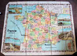
Andrew Lesot "France Politique", large folding map, dissected, linen-backed, c.1880, coloured lithograph. 100 x 127cm. VG condition.
Andrew Lesot "France Politique", large folding map, dissected, linen-backed, c.1880, coloured lithograph. 100 x 127cm. VG condition.
Lot 125
Lot: 125
- Auction Date: Wed 20th Nov 2024 12:00 GMT (Ended)
- Est: £10 - £20
SOLD £12
MORE DETAILSAndrew Lesot France Politique, large folding map, dissected, linen-backed, c.1880, coloured lithograph. 100 x 127cm. VG condition.
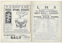
Bradshaw’s LMS folding Timetable with Maps publicising connections with sailing times to the Continent and Belfast. VG.
Bradshaw’s LMS folding Timetable with Maps publicising connections with sailing times to the Continent and Belfast. VG.
Lot 133
Lot: 133
- Auction Date: Wed 20th Nov 2024 12:00 GMT (Ended)
- Est: £10 - £20
SOLD £10
MORE DETAILSBradshaw's LMS folding Timetable with Maps publicising connections with sailing times to the Continent and Belfast. VG.


